I have begun my GIS project which will (hopefully) form a large part of my PhD, aid me with my observations and conclusions and - as an additional feature - look rather pretty ;-)
The software I use for this is none lesser than the renowned gvSIG which has been used by OA for a while now, and has undergone some development by the IT crowd. The version I use is the newly released OA Digital Edition, all nice, polished and open source. You can download it here. It certainly is my recommendation when picking open source GIS tools for any use! It even comes with a userguide - enjoy!
Enough advertising. I commenced my project by downloading the maps from the Digital Egypt website for the purpose of basemapping.
My initial problem during the georeferencing was the projection. In the end I decided that WGS 84 would be the best choice, as the info provided on these maps was given in lat/long. This worked well enough until I realised that some of the co-ordinates which should have been on the corners are missing. Oh well, some maps worked through guessing, many will (hopefully not) have to stay unreferenced for the time being...
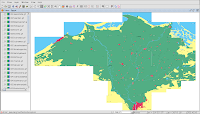
Here's an impression of the Delta:

Some of the margins so not fit properly and it would take some time getting them all to match...
I decided to look elsewhere:
Maproom has a nice collection of data from all over the world. An abundance of information, especially in terms of administrative boundaries, is available - not all necessary, but free and nice to have. Problematic is the fact that the data comes in ArcInfo format, which is old and not very nice to use at all. Furthermore it is proprietary to ESRI and it can be a hassle to convert it. Please read here to see how the nasty route via ArcGIS and the likes can be avoided! ;-)
Maplibrary is also very useful. I like the georeferenced satellite images in particular, but the other data, boundaries mostly, is very nice. It comes in ESRI shapefile format (not only, but in my opinion the most sensible) and can be added to one's GIS project easily.
Last but not least, the CGIAR-CSI provide free SRTM 90m Digital Elevation Data for the whole of Egypt, which I used as well.
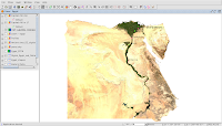
Here's an initial shot of SRTM data with Maproom on top. Funky stuff, but rather simple for now:

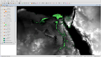
The current "state of affairs" - The cropped satellite image with a shapefile I made - sites of special interest to my research. The metadata is contained in the .dbf file:

I have played with contour line creation and the like but have not come very far yet. Please be patient, further updates on this front are to follow soon!


2 comments:
Nice! I'm starting to understand what you've been talking about when telling me about your maps.
Hello, Anna:
Which parts of Egypt interest you the most? I have seen that, for example, the great pyramid of Giza is more or less at the south-most tip of the Delta.
Perhaps I can send you some nice satellite images of Egypt in ECW format, which can be opened with gvSIG.
The screenshot 'impression of the Delta' is the zone that interests you the most?
Regards,
Juan Lucas Domínguez Rubio
jldominguez [at] prodevelop [dot] es
Post a Comment